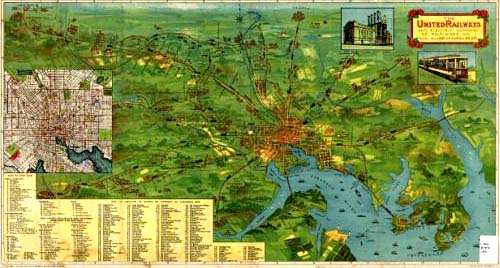
Railway Map of Baltimore (1910)

By “The 59 King” (Curator, The Big Map )

The map was produced by the United Railways and Electric Company in 1910. The image is freely downloadable by anyone at its highest resolution [7,999px × 4,317px].

View the ZOOMABLE map at The Big Map Blog.

This entry was posted in 1910s, Neighborhoods and tagged . Bookmark the permalink.

Leave a Reply

Your email address will not be published. Required fields are marked *

This site uses Akismet to reduce spam. Learn how your comment data is processed.